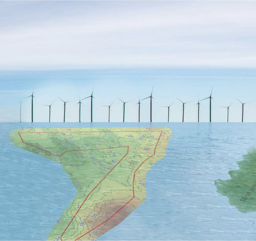
The report deals with the geological background and seismicity of a potential wind farm area, a 7-shaped polygon framed offshore western Saaremaa, some 10–40 km off the Sõrve peninsula. No particular geological/geophysical research was carried out for this report. All the descriptions and conclusions about the geological background presented rely on interpretations of two former seismo-acoustic/multibeam data sets available from this area:
1) The Swedish-Estonian airgun (250–500 Hz) study on the bedrock strata of the central Baltic Sea from early 1990s and,
2) the seafloor mapping data set collected in 2017–2024 by the Estonian Maritime Administration using a multibeam sonar and chirp-type (2–9 kHz) seismo-acoustic transmitter.
The sea depth is 12-45 m with two different geological settings: shallow marine areas up to 30 m represent higher patches of the limestone plateau; the deeper sea area over 30 m is found above the bedrock slope-depression area in the form of solitary deep valleys that have been carved into the clayey, easily erodible limestones of the Kuressaare, Kaugatuma and Ohessaare stages. The depth of the bedrock varies largely between 25–30 m and 40–60 m below sea level within the limestone plateau and slope-depression portions of the wind farm area.
The region of Estonia is geologically stable and only modestly seismically active. Sporadic occurrence of minor (magnitude < 3) earthquakes is typical. It is a challenge to form a comprehensive understanding of seismicity in such an area of low activity.